
Atigun Pass, Alaska: Crossing the Roof of the Dalton Highway
North of the Arctic Circle, the Dalton Highway climbs steadily toward a narrow opening in the Brooks Range. The road bends between steep, treeless slopes, the Trans-Alaska Pipeline appears and disappears beside it, and the country begins to feel even larger than it did a few miles earlier. Then the highway reaches Atigun Pass—one of Alaska’s most dramatic road crossings and the highest point on the Dalton Highway.
Atigun Pass is more than a scenic summit. It is a continental divide, a weather boundary, a wildlife corridor, and a powerful transition between Interior Alaska and the North Slope. For travelers who make the long journey, it is also a reminder that some of Alaska’s most memorable places demand patience, preparation, and respect.
Where is Atigun Pass, Alaska?
Atigun Pass is located at approximately mile 244 of the Dalton Highway in northern Alaska. The Bureau of Land Management lists its elevation at 4,739 feet. Here the road crosses both the Brooks Range and the Continental Divide.
The pass lies roughly 70 road miles north of Coldfoot and about 170 miles south of Deadhorse. It is remote even by Alaska standards. There are no shops, hotels, or fuel stations at the summit—only the highway, mountains, pipeline, weather, and whatever wildlife happens to be moving through the area.
The Dalton Highway itself stretches 414 miles from near Livengood to Deadhorse. It was originally built as an industrial road to support construction and operation of the Trans-Alaska Pipeline System. Commercial trucks still make up much of its traffic, carrying fuel, equipment, and supplies to the North Slope. Visitors are guests on a working road and should give large trucks plenty of room.
A crossing that divides watersheds
The phrase “Continental Divide” can sound like a line drawn on a map, but Atigun Pass makes the idea visible. Water on the south side eventually drains toward the Pacific Ocean or Bering Sea. Water north of the summit flows toward the Arctic Ocean.
The landscape changes with the drainage. South of the pass, the highway approaches through the narrow valleys and sharp ridges of the central Brooks Range. North of it, the terrain gradually opens toward broad tundra and the immense sweep of the North Slope. The crossing feels like a doorway between two Alaska regions.
That transition is part of what makes Atigun Pass so memorable. A traveler can move from boreal forest near Coldfoot, through mountain valleys, over the divide, and into nearly treeless Arctic country within a single day. The distance is significant, but the ecological change feels even greater.
Why is Atigun Pass so important?
For drivers, the pass is the high point of the Dalton Highway. For commerce, it is a critical link between Interior Alaska and the North Slope. The highway and pipeline corridor thread through terrain that otherwise remains largely roadless.
Atigun also sits near the eastern edge of Gates of the Arctic National Park and Preserve. The highway does not enter the park, but for many miles through the Brooks Range the park’s vast mountain wilderness lies to the west. There are no roads or established trails inside Gates of the Arctic, which makes the Dalton corridor one of the few places where motorists can look directly into this enormous northern landscape.
The pass also marks a natural movement route. Dall sheep are frequently seen on rocky slopes near the highway. Depending on season and location, travelers may also see caribou, grizzly bears, wolves, golden eagles, peregrine falcons, or other northern wildlife. Sightings are never guaranteed, and animals should always be observed from a safe distance. Pull completely into a designated or safe parking area rather than stopping in the roadway.
Weather can change in every season
Atigun Pass is beautiful because it is exposed—and that exposure makes weather a serious concern. The BLM notes that snow can fall in June or July. The Alaska Department of Transportation and Public Facilities warns that severe weather and avalanches can temporarily close the highway and leave travelers stranded.
Even a summer drive can include cold wind, rain, snow, fog, or rapidly reduced visibility. Winter conditions may begin in August and continue into June. Weather at lower elevations does not reliably predict conditions at the summit.
Before leaving Fairbanks or Coldfoot, check Alaska 511 for current road conditions and closures. Conditions at Atigun Pass can change after a trip has begun, so continue checking whenever service is available and pay attention to roadside signs and official instructions.
Planning a responsible Dalton Highway trip
A journey to Atigun Pass should never be treated like an ordinary scenic drive. Services are limited, cell coverage is unreliable, and help may be far away. Alaska DOT recommends a reliable vehicle capable of handling rough conditions, along with extra fuel, food, water, warm clothing, first-aid supplies, spare tires, and emergency equipment.
Travelers should also:
- Confirm that a rental vehicle is permitted on the Dalton Highway.
- Allow commercial trucks to pass and avoid lingering in their blind spots.
- Slow down when meeting vehicles on gravel to reduce windshield damage.
- Carry more than one way to repair or replace a damaged tire.
- Keep headlights on and expect changing road surfaces.
- Leave a trip plan with someone who will notice if you do not return.
- Use established pullouts and avoid blocking gates, access roads, or pipeline facilities.
- Pack out all trash and leave tundra, plants, and cultural resources undisturbed.
A guided tour is a sensible alternative for travelers who want the experience without managing the driving and emergency logistics themselves. Whether driving independently or traveling with a guide, flexibility matters. Turning around because of weather or road conditions is sound Alaska judgment, not a failed adventure.
The best time to visit Atigun Pass
Most independent visitors travel the Dalton Highway during the warmer months, when daylight is long and visitor services are more available. Early summer may bring lingering snow along the mountains. Later summer can add deeper tundra colors, but freezing conditions and snowfall become increasingly possible.
There is no season when Atigun Pass is completely predictable. That uncertainty is part of the landscape, but it should never be romanticized at the expense of safety. The best visit is one made with realistic expectations, current information, adequate supplies, and enough time to change plans.
For travelers still planning the route north, our earlier article What Is the Arctic Circle? explains another important landmark along the Dalton. For a very different way to experience Alaska by rail rather than remote highway, explore Alaska Railroad Routes: A Journey Through the Great Land.
The story behind the Atigun Pass Bracelet
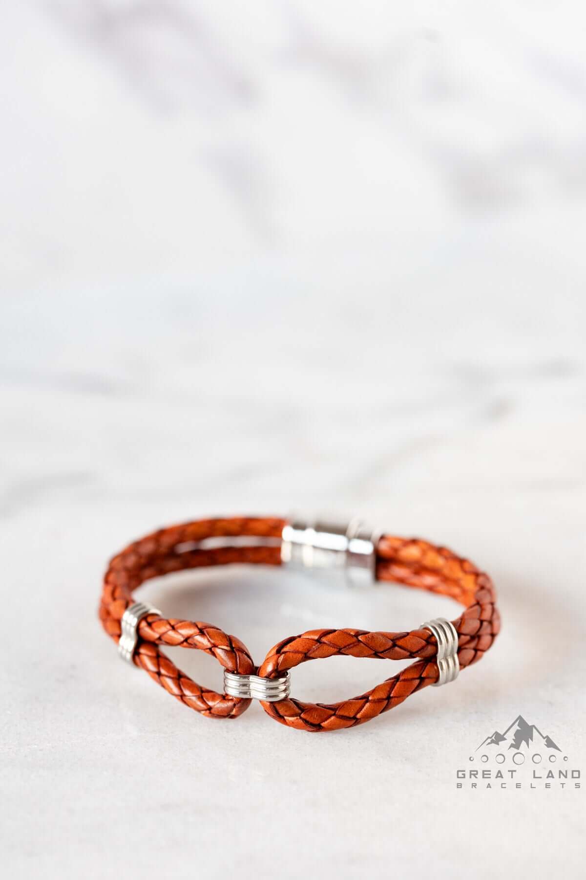
The Atigun Pass Bracelet translates this mountain crossing into a simple wearable design. Two genuine leather loops represent the two sides of the Continental Divide, while a narrow stainless-steel bead marks the pass between them. The bracelet is fixed-size, with several sizes and custom sizing available.
It is a design for someone who has driven the Dalton, dreamed of seeing the Brooks Range, worked along Alaska’s northern corridor, or simply connects with the idea of a narrow passage through formidable country. The meaning comes from the place: a line through the mountains where waters separate, landscapes change, and the road continues north.
Carry the crossing with you
Atigun Pass does not need grand buildings or elaborate signs to make an impression. Its power comes from the scale of the Brooks Range, the curve of the highway, the openness beyond the summit, and the knowledge that every mile depends on preparation.
That makes it a fitting Alaska story to carry. Wear your Alaska™ can mean remembering a place you crossed, honoring a journey still ahead, or keeping close the quiet confidence that comes from meeting wild country on its own terms.
Sources and further reading
-
Posted in
Alaska, Alaska Travel, Arctic Alaska, Atigun Pass, Atigun Pass Bracelet, Brooks Range, Dalton Highway, Wear your Alaska